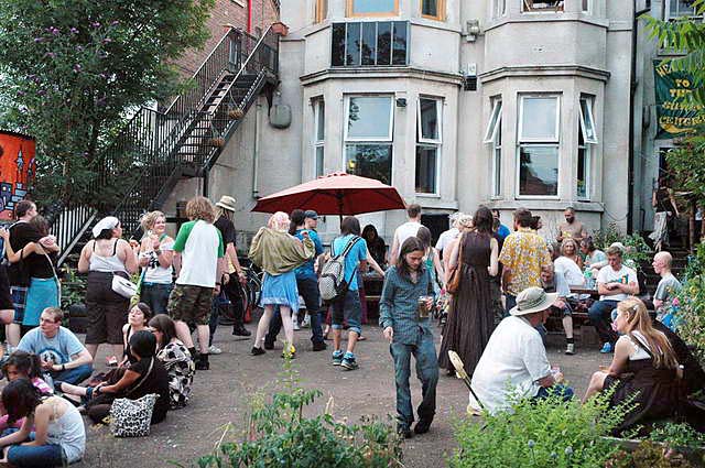
The Sumac Centre is based in the Forest Fields & New Basford neighbourhood, west off Sherwood Rise at Alberta Terrace, opposite the top of Exeter Road – look for the big trees by our big yard.
There is a wheelchair accessible entrance at the back door at 73 Beech Avenue, NG7 7LR
| ONLINE MAPS: | ||||
Gladstone Street bridges Forest Fields and New Basford, 1.5 miles from the City Centre of Nottingham.
From the Victoria Centre, follow Mansfield Road (A60) to the roundabout by the Forest Recreation Ground. Turn at the 2nd mini roundabout onto Sherwood Rise (B682 to Bulwell). Gladstone Street is on the left, after Berridge Road, by the 3rd pedestrian crossing (‘leading from Albany Terrace’).
The Centre is 200m along on the right, just after crossing Foxhall Road.
Accessible level access
73 Beech Avenue, New Basford NG7 7LR (via Sherwood Rise)
Buses
Buses 68 and 69 from Milton Street, by the Victoria Centre (bottom of Mansfield Road) runs up Sherwood Rise (between Gregory Blvd & Nottingham Road), towards Highbury Vale, Bulwell, Hempshill Vale and Snape Wood, whilst 70 and 71 go to/from Arnold. Ask for the Berridge Road stop and walk as above.
Bus L12 is an out of town route between Nottingham University (Portland Hill) via QMC Derby Road, Jubilee Campus, Ilkeston Road and Radford Boulevard to the City Hospital (Hucknall Road/Valley Road). Get off at Sherwood Rise Health Centre stop & walk back to Gladstone St (or Beech Avenue) on the right.
The 89 route operates every Friday and Saturday night as the N89 from the City Centre (at 1.15, 2.15, 3.15am) via Hucknall Road (4mins walk from Sumac), to Edwards Lane, Bestwood Park, Rise Park and Top Valley.
N.E.T. Tram
Nottingham Express Transit from Basford, Hucknall and Phoenix Park & Ride stops at the end of Gladstone Street. From the north, get off at ‘Radford Road’. Walk back to turn right onto Gladstone street.
From the Train or Coach Station, the Old Market Square & all points south, including Beeston, Clifton and Toton Lane park & ride, take the tram to ‘Beaconsfield Street’. Follow the tram on foot to turn right onto Glasdstone Street (where the tram turns left).
Sumac Centre is about 5 minutes walk to 245 Gladstone St – look for the wide gates on the left by the big trees.
Note that the tram does not allow dogs (except guide dogs) or bikes (unless folding), and since opening the tram through buses to the station no longer run from Radford Road.

Nottingham Express Transit Tram Information and Timetables
Cycle Route
Gladstone Street is a traffic calmed recommended cycle route.
From the City Centre, quiet roads run parallel to Mansfield Road, with cycle paths across the Forest.
View the Nottingham City cycle info here.
This map shows the City Centre and areas to the north, for Sumac.
This map shows City Centre and areas to the south.
Sustrans National Cycle Route 6 from Derby, Long Eaton, Beeston and Nottingham University, to Mansfield and Worksop, runs less than a mile away.
Driving

If you are driving from out of town, from the M1 leave at junction 26 towards Nottingham on the A610.
After 2.6 miles turn left onto A6514 Western Boulevard (the Ring Road towards Mansfield (A60)). Drive past the McDonalds on the right (pausing only to distribute some leaflets!).
Then turn right towards the City Centre (B682). Just short of a mile turn right by a pedestrian crossing, onto Alberta Terrace / Gladstone Street. (Turn instead onto Beech Avenue for the accessible entrance at 73 Beech Avenue).
The Centre is 200m along on the right, just after crossing Foxhall Road.
Please keep our neighbours’ parking spaces clear.
For Park & Ride from the M1 use Toton Lane from J25 or Phoenix Park from J26 and take tram as above.
Get a personalised map and directions to Sumac:


